Logo

OFFERING A FULL RANGE OF DRONE AND UAV SERVICES INCLUDING SURVEYING

AND MAPPING, PILOT SERVICES AND COMPLETE BUILD SERVICES

Owner: Robert J. Rubino


  • Colorado PLS 14142
  • United States Mineral Surveyor


Contact Information:


3312 Airport Road
Boulder, Colorado 80301
Phone: (303)464-9515
Fax: (303)464-7792
email: rubinosurveying@aol.com

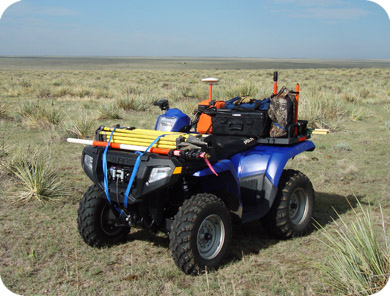
FULL RANGE OF SURVEYING SERVICES

Rubino Surveying is proud to offer a full range of surveying services
for all of our commercial and residential clients, for example:


  Interested in a FREE and Painless quote?

We are always happy to provide you with an online quote for
any of your upcoming surveying needs.  Just go to our online
"Survey Quote Request" page, provide us with some very basic
information, and we will gladly respond online with a quote.


SPECIALTY SURVEYING SERVICES


DRONE AND UAV SERVICES

4 WHEELER

FEMA ELEVATION CERTIFICATES
(brief description)


FEMA Elevation Certificates are used to determine the relationship of structures to the base flood elevations for properties lying within a flood hazard area. This survey is used to help establish the potential danger to structures in times of high water and often required by insurance carriers in their risk analysis of certain properties. Elevation Certificates are used many times to demonstrate that the structures are above the base flood elevations which may relieve the property owner of annual flood insurance costs.

IMPROVEMENT LOCATION CERTIFICATE or ILC (brief description)


ILC's are used to provide the client with a quick and inexpensive "snapshot" of the the property in question. This certificate (not referred to or labeled as a survey for good reason) can help determine if an actual survey is required for further analysis of the property but many times the ILC is all that is needed to make educated decisions about the property and it's improvements.

IMPROVEMENT SURVEYS
(brief description)


An Improvement Survey is essentially a Boundary Survey (see Boundary Survey description) with the addition of locating all improvements situated on the property and showing all survey data on the deliverable which is called an Improvement Survey Plat. This type of survey is particularly useful if the property owner is contemplating adding to existing structures or building new structures and property line setbacks are of concern.

TOPOGRAPHIC AND DESIGN SURVEYS
(brief description)


Topographic and design surveys are used primarily for future development of the property and are generally requested by civil engineers and architects for their use in the design process. Adding elevations to the survey is what sets it apart from other types of surveys. The level of precision and detail of the survey are determined by the engineer or architect which in turn drives the cost of the survey. These surveys are also referred to as "Architectural Design Surveys" or "Architectural Surveys".

BOUNDARY SURVEYS (brief description)


A Boundary Survey (official name is Land Survey), also called "Pin Survey" by many, is a survey where the surveyor establishes the lines of the property and sets a permanent marker or monument at each corner of the property. The drawing prepared by the surveyor graphically depicting all relevant information obtained during the survey is called a Land Survey Plat which is delivered to the client.

ALTA SURVEYS (brief description)


An ALTA Survey is a survey made to national standards that begins with a complete boundary survey, then all improvements situated on the property are accurately located. The surveyor is also tasked with reviewing the title commitment and plotting all easements and other matters of record which can be graphically shown on the survey. In addition to the standard requirements of an ALTA Survey there are "Optional Table A" items that may become part of the survey at the client's request. These items may include contours, building size and height, building setback and height restrictions, utility locations and adjacent owner information just to name a few. An ALTA Survey gives the owner or prospective buyer a very complete "picture" of the property.